After the village attractions are mapped, the undiscovered village in the Rwenzori foothills soon will receive global visibility after being added on open street map. For experienced travelers, Ruboni village is the next surprise destination to you and your friends or family.
Back ground
For many years, since the 1906, Ruboni village has been open to travelers trekking the Rwenzori Mountains through the central circuit trail. This central circuit trail is the best and closed trail leading to margarita peak, the highest point of Uganda at 5019 meters above sea level. None the less, Ruboni has been hidden from the mainstream travelers. Even people who have come to queen Elizabeth national park, 40km away, didn’t know anything about Ruboni village.
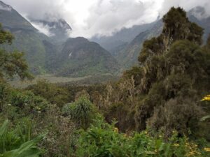
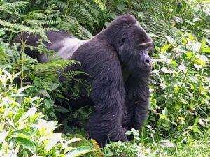
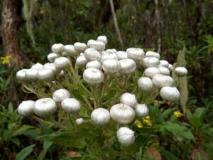
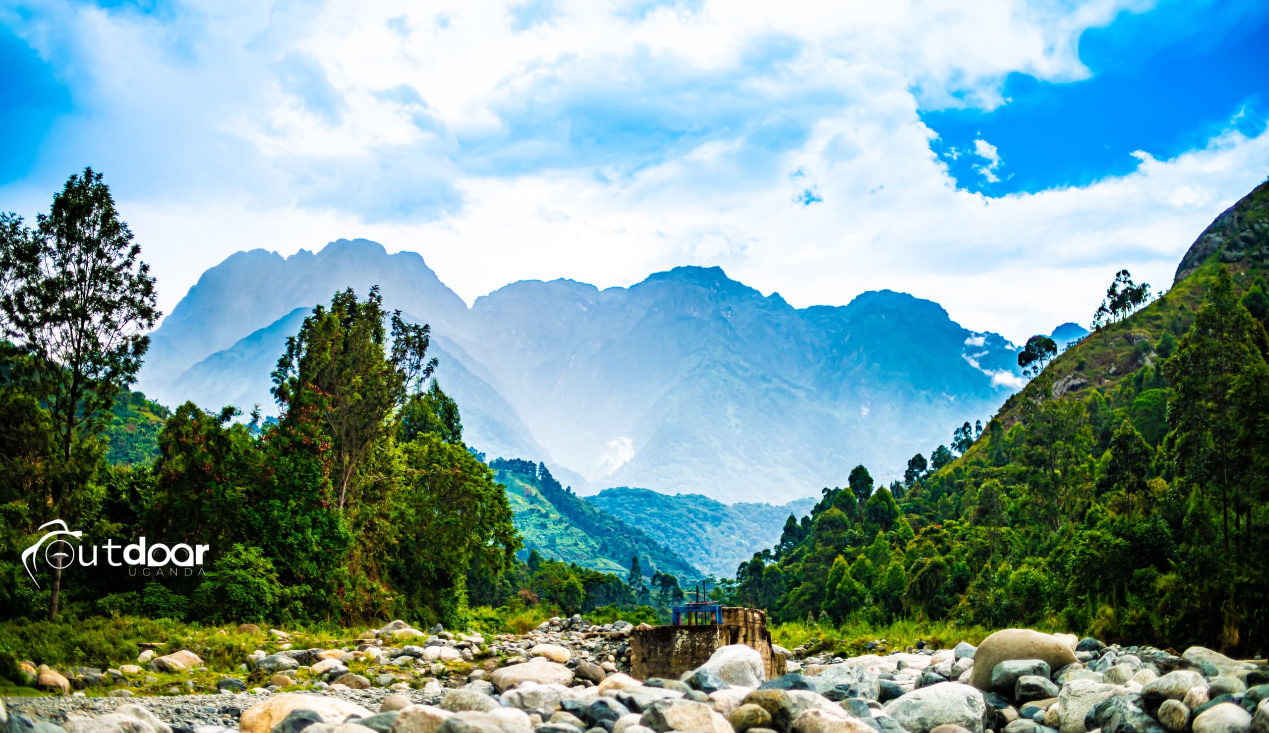
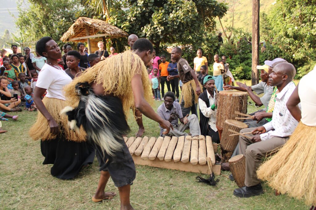
Besides being an easy access to Rwenzori highest peaks, Ruboni village is home to a long list of tourist attractions that every traveler to Uganda must not miss. The beautiful hills, the forests with unique wildlife, the culture and the beautiful rivers with water falls flowing from the Rwenzori Mountains glaciers. The soil in Ruboni is very fertile that everything put on the ground germinates to a lush vegetative health.
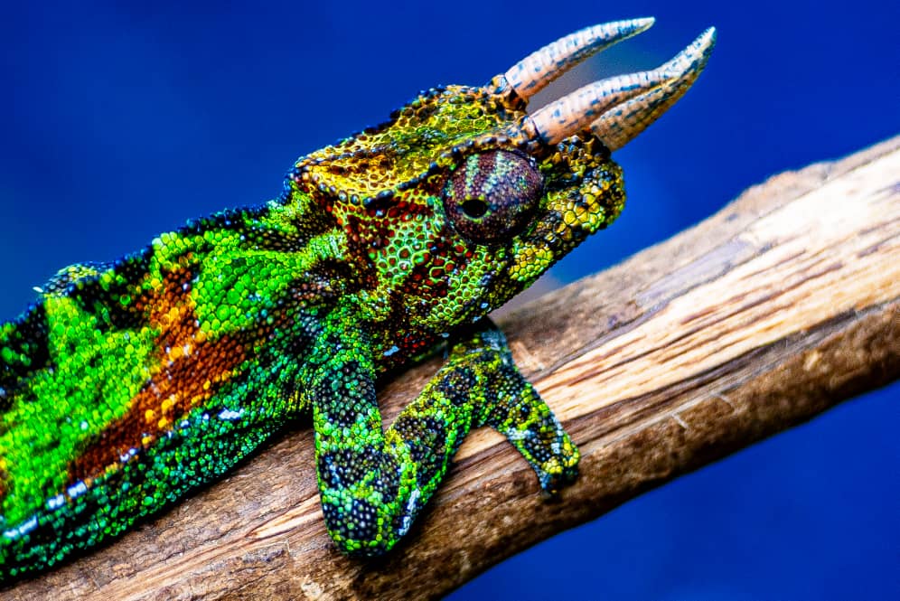
To enhance visitation, in 2002, the community created forest and cultural trails in the village outside the park. These trails take guests to the natural forests, hill tops, households, village farms and waterfalls looking to meet the people and wildlife such as the three horned chameleons. Along with the trails, the community created a tourist lodge on the hillside offering the beautiful views of the portal peaks and foothills. To date, the village has over ten tourist accommodation lodges, home stays and campsites. In total they have up to 100 rooms in all lodges per night.
As the population increases, land output and productivity lowers or due to the impacts of climate change, tourism is a perfect alternative livelihood to the people living in such a beautiful location. Ruboni community has taken the effort to enhance tourism attractiveness of the area by creating the nature and culture reserves, along with a pool of other tourism products. However, lack of availability of the information about Rubonis tourism potential is still a bottle neck to this potential livelihood.
Ruboni village stretches for 18 km from the national park boundary connecting to the Kasese – fort portal road. Kasese – fort portal road is a major tourist route in western Uganda. It connects the major national parks including Queen Elizabeth, Kibale, semuliki, Murchison falls, and Bwindi forest gorilla National Park. However, all guests passing through this road don’t know a thing about Ruboni village attraction and or Rwenzori Mountains.
Ruboni Community Conservation and Development Program (RCCDP), the pioneer of community tourism in this area thought it wise to consolidate and map the tourism attractions of this area. This was made possible with the finanicla support from the Humaniterian Openstreetmap Team (HOT), and with the cooperation of all stakeholders including the local youth, government and private sector.
These village attractions are mapped
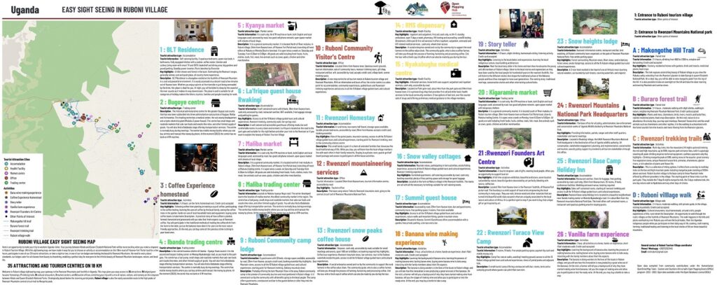
This map has been completed, and currently up and running. The map is available in three versions;
- The printable version that can be downloaded here,
- The digital interactive version that can be viewed here, and
- The addition of all Ruboni housing and tourist features on Openstreet Map
It is worth noting that, the youth of Ruboni have contributed a lot to the development of this map. Actually they have owned the process during and after the mapping process. In total, 40 youth and 18 women were trained and involved in the mapping process. They were also empowered with mapping skills. These youth will manage the map all through, to edit and update the online and digital maps whenever new changes are required. This way, the youth own the process and therefore the tourism products on the map and in the village.
How Ruboni tourism village will share the map
Ruboni village will print a few copies and distribute them to the stakeholders. The printable version shared in PDF is available for download and printing by anybody willing at no charge. The digital interactive version and the one on Openstreetmap are freely available for use online and. On the other hand the map will enhance digitization of tourism in Ruboni village, making the destination available to the travelers wherever they are. The proposal is, the map link will be shared to as many tourism platforms as possible so that it can go out there.
Activity benefits and way forward
This map enhances inclusiveness for the local tourism businesses. All tourism experiences in Ruboni village will be equally visible despite their ownership. The map will be enhanced by a mobile application that will soon be completed under the same project. This application will deliver the map all salable tourism products such as hotels, tours and stopovers and the tourism information required by the travelers to be able to choose Ruboni village as their destination.
However, an effort is still needed to make this map work for Ruboni village. It needs to reach out to the market. We request you to share the map extensively to ensure that it is accessed and used by the potential visitors to destination Uganda. This will help to position tourism as an alternative sustainable livelihood for Ruboni village residents so that the beautiful landscapes, friendly people, forests, culture encounters and a lot more are set to sustainably enhance community well-being. You can view and share this interactive map here